Chemical contaminants turn carbon surfaces ultra-slippery
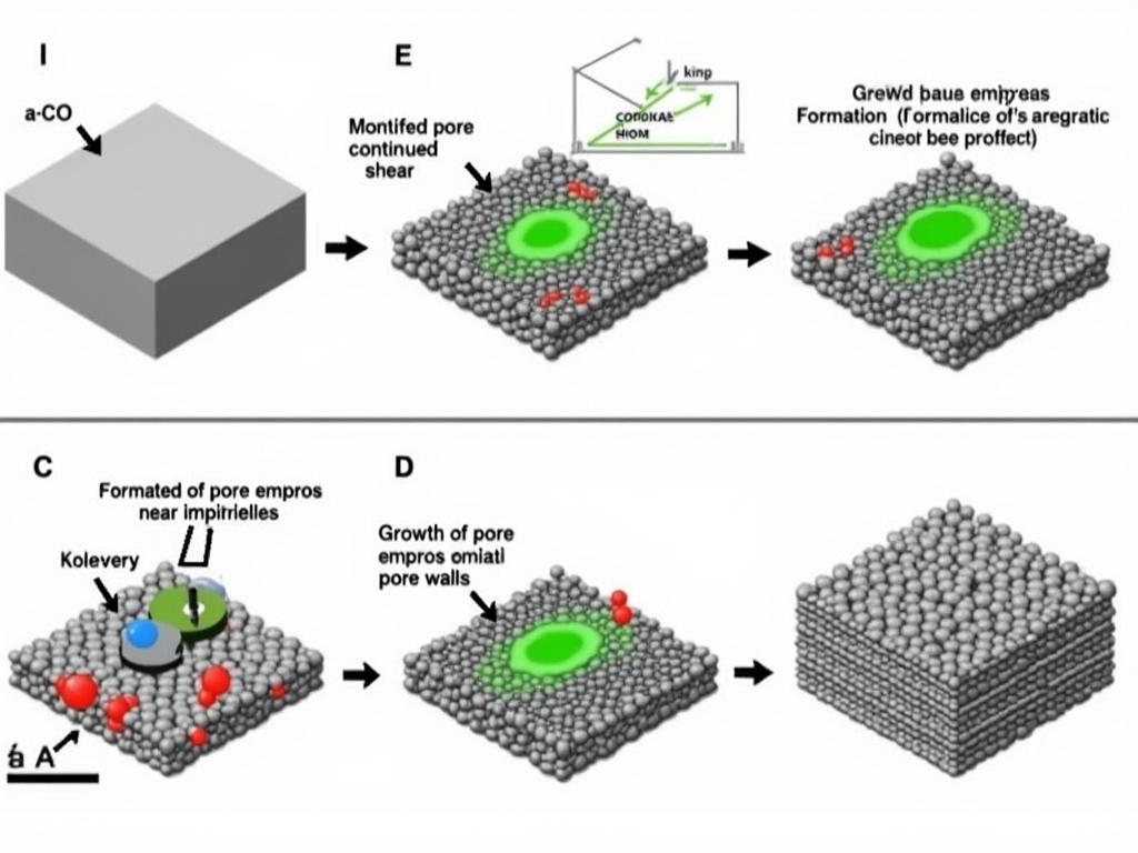
When materials are subjected to sliding forces, small amounts of impurities such as oxygen can actually help stabilize nano-sized voids in amorphous carbon (a-C). This stabilization allows nearby carbon atoms to rearrange into aromatic, graphene-like configurations that promote extremely low friction. Credit: Osaka Metropolitan University Impurities are typically viewed as flaws that should be eliminated to enhance material performance. However, new findings from Osaka Metropolitan University
17 likes
596 views